
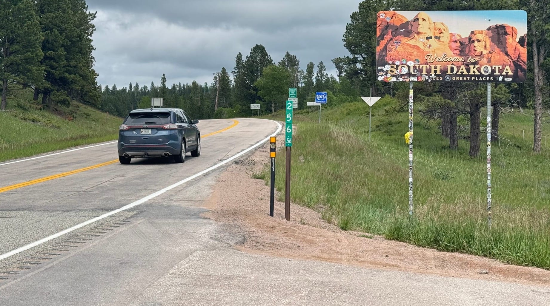
CHEYENNE CROSSING, S.D. – Colorado tourists Kay and Dan Rider made a conscious decision to avoid interstates and busy highways on their way to a family vacation in western South Dakota.
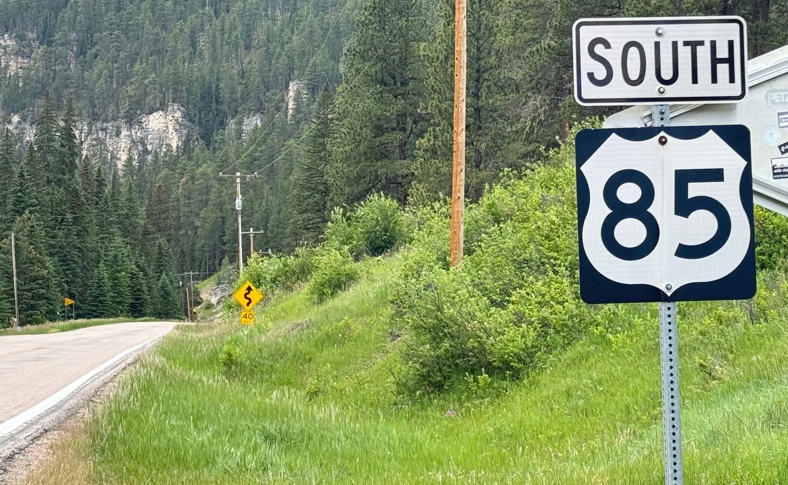
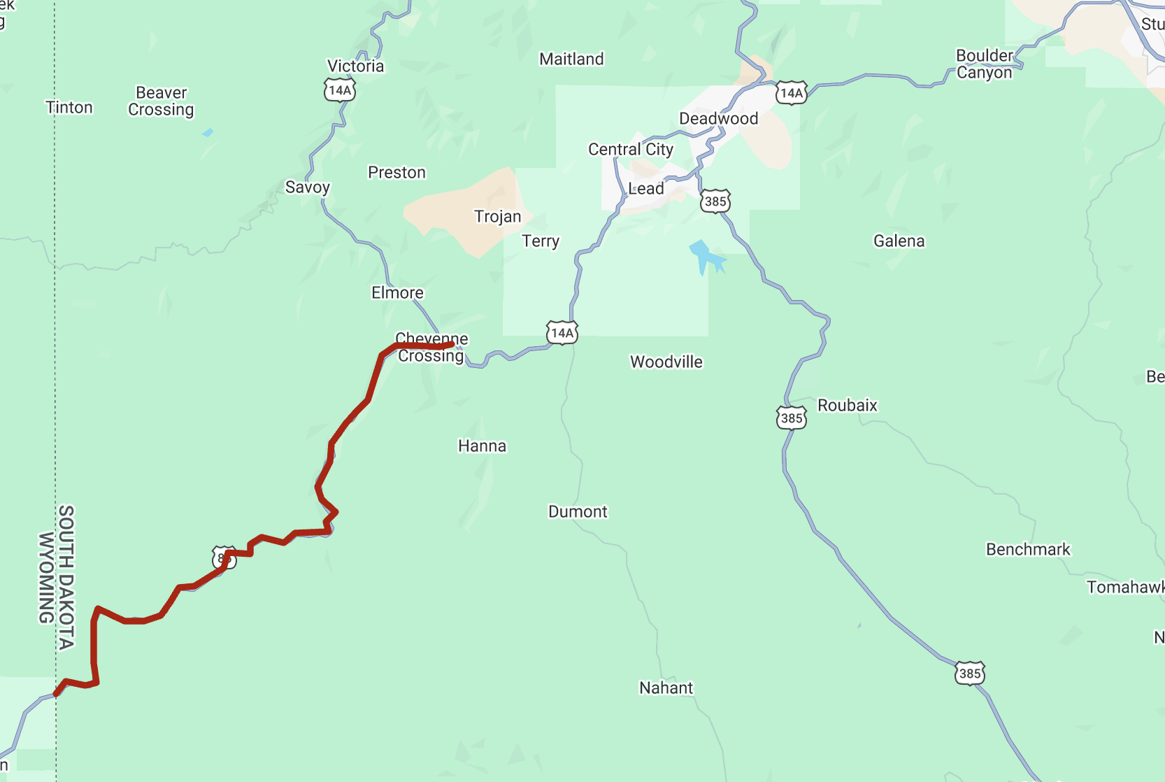
The decision to take the scenic route led them to a stretch of U.S. Highway 85 in the northern Black Hills on June 25 that would eventually take them through the Lead/Deadwood area on their way to Rapid City.
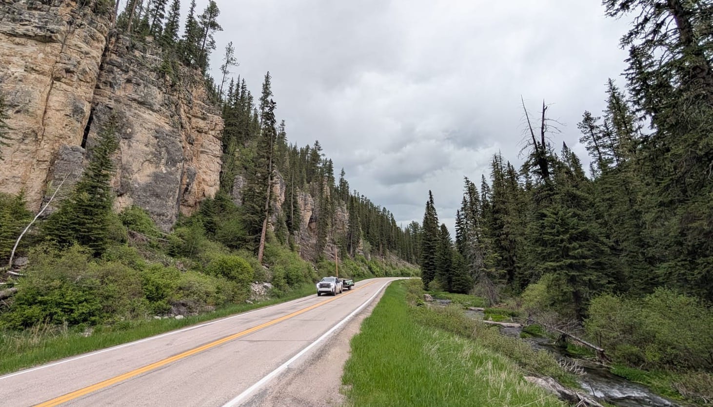
The couple stopped briefly to take a break in one of the many pull-offs that straddle the highway. The small parking areas provide motorists with a spot to soak in the beauty of the majestic pines and rocky ridges that frame the highway or to find calm in the gentle babble of Spearfish Creek that flows a few feet from the travel lanes in some areas.
"This is wonderful," Kay Rider said of the highway. "We've just been talking about how beautiful the drive is and what great shape the road is in."

The Riders were surprised to learn that the state of South Dakota has plans for a major reconstruction of that 16-mile stretch of U.S. 85 from the Wyoming border on the west to its intersection with U.S. 14A at Cheyenne Crossing on the east.
The couple said it didn't make sense to them that the Department of Transportation would do anything that could alter the aesthetics of the highway.
"If I was paying taxes in South Dakota and that money was going to this project, I would be highly upset," Dan Rider said.
Similar US 385 project spurs concern
That sentiment is shared by more than a few residents and business owners in the Black Hills region.
As it plans the $47 million project that could begin in 2030, the state DOT has received extensive public input, some in support of its efforts to improve the condition and safety of the highway, but much more in opposition.
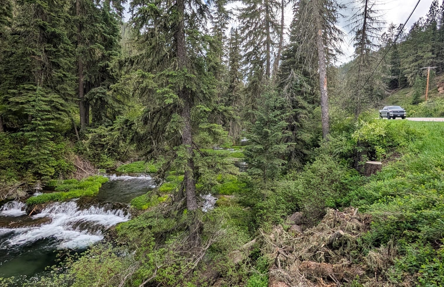
"It’s hard to define the character of the Black Hills, but you kind of know it when you see it," said Paul Horsted, a renowned nature and landscape photographer from Custer who is opposed to the current plans to redo U.S. 85. "The scenery and the stream on one side of the road and the cliffs on the other side – there's nothing that can match that."
Horsted said he and others are worried that the DOT could take the same approach to rebuilding U.S. 85 as it has with the ongoing project to reconstruct U.S. 385, another scenic road through the Black Hills.
That three-year, $72 million project that will conclude in 2027 is bringing wider lanes, extended road shoulders and fewer curves to the north-south highway between Deadwood and Hill City. To improve safety, the DOT has made more room for the highway by clearing trees, blasting rock and scraping away ridges.
Roadwork on U.S. 385 is continuing with flaggers and 15-minute delays between Pactola Reservoir and Calumet Road. The highway will be fully open on July 4 and during the Sturgis motorcycle rally in early August.
Horsted said the U.S. 385 project will surely improve safety but will come at the cost of a loss of scenic views, ecological diversity and uniqueness. Horsted said overly invasive road projects are part of what he calls the ongoing "urbanization" of the Black Hills.
"None of us are against safety measures, but my question is whether the only answer to make a road safer is to widen it," Horsted told News Watch.
"I understand they need to resurface it and make it drivable, but please try to do with a sense of what the Black Hills are all about."
– Paul Horsted, renowned nature and landscape photographer from Custer
Horsted, whose latest project "South Dakota Yesterday & Today" contains modern photos of historic sites across the state, suggested the DOT could make U.S. 85 safer by adding a shoulder on only one side or lowering speed limits.
"I understand they need to resurface it and make it drivable, but please try to do with a sense of what the Black Hills are all about," he said. "We’re asking the DOT to do the minimum necessary to build a reasonably safe road that maintains the scenic and ecological aspects of this beautiful Black Hills highway."
State says safety concerns driving project
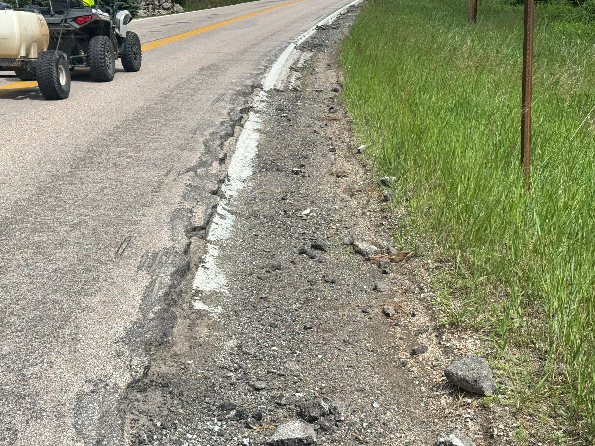
DOT reports show the existing roadway is in poor condition, has 20 curves with reduced speed limits and is marred by eroded roadway edges. The highway has been re-graded, resurfaced or repaired 10 times since 1950 but hasn't been upgraded since a resurfacing project in 2010.
The major goal of the project is to improve safety by widening the "clear zones" in which vehicles have wider lanes and additional space to maneuver in case they leave the travel lanes. The highway sees about 600 vehicles per day on weekdays and roughly 850 vehicles per day on weekends. The speed limit is 55 mph in most stretches.
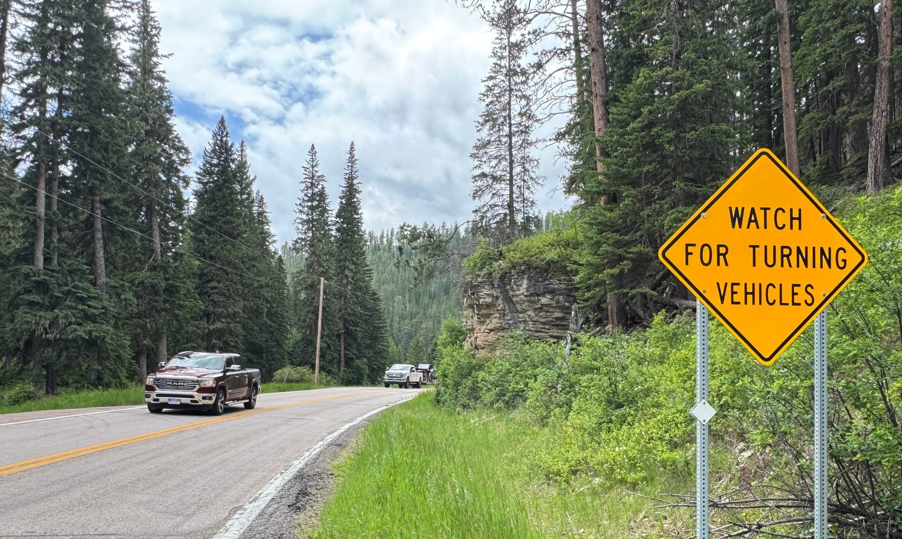
The preliminary plan is to resurface the roadway and widen traffic lanes from 11 feet to 12 feet in most areas and add 4-foot to 6-foot paved shoulders where ditches or rocky outcrops mostly exist now. Some curves could be straightened.
High crash rate for cars and motorcycles
The 16-mile stretch of two-lane highway had 140 crashes with three fatalities and 56 injuries reported during the decade from 2013 to 2022. About a third of the accidents involved motorcycles, and nearly two-third of wrecks came from vehicles leaving the roadway. More than 20% of wrecks resulted from wild animal encounters, according to DOT data.
The crash rate on the road of 8.5 accidents per million vehicle miles traveled was nearly six times the state average of 1.5 accidents for similar highways over that decade, the DOT said.
More recent crash data, from 2020-2024, showed 77 accidents with one fatality and 31 injuries and a crash rate that rose to 9.1 per million vehicle miles. Four vehicles ended up in Spearfish Creek during that five-year period, DOT said.
"This corridor is very unique, (and) as we develop alternatives or refine current options, we will continue to request input from stakeholders and the public to refine ways to modify the design such that we minimize work near the creek, ensure the natural flow of surface water is capitalized, and strive to reduce impacts to adjacent property owners," DOT spokeswoman Julie Stevenson wrote to News Watch in an email.
Stevenson said the agency is considering construction of a short retaining wall to protect the creek. Plans for lane or road closures are not yet set, she said.
Get South Dakota news and information in a free email on weekdays. Cancel any time.
"Having a safer highway and an aesthetically pleasing highway do not have to be mutually exclusive," she wrote. "The challenge is to balance the impact on the environment while trying to advance safety benefits to the roadway user."
After receiving significant public input already, the DOT has extended the written comment period this year from the original date of June 19 to Sept. 4. Written comments may be made on the agency website or via email at mark.malone@state.sd.us.
Neighbor has witnessed two crashes
In providing a rationale for the project, DOT officials used the example of improved safety that occurred on a stretch of U.S. 14A when a curvy stretch of road was straightened with wider lanes and shoulders in 2020. That project reduced the number of crashes from 2.6 per year to less than one crash per year.
Steve Paula, 74, lives in Brookings but spends a couple months a year at his cabin located on the north side of U.S. 85 a few miles west of Cheyenne Crossing.

Paula said he has witnessed two accidents in recent years that were caused in part by the poor condition and curvy configuration of the highway.
In one, a motorcyclist flipped off his cycle after braking too hard when turning on the sharp curve where Paula's cabin is located. Another time, a biker wrecked after his tires left the roadway and were caught by uneven shoulders that have worn off over time.
"Look at the road and look at the shoulders because it's an 8-inch drop where it falls off," Paula said while standing in the driveway of his cabin. "On a motorcycle, a bicycle or even a car, you have no way to make it back from that, and you're going to have an accident."
Paula said a new surface, improved shoulders and a lower speed limit could make the highway safer without more invasive interventions.
He said he understands the opinions of many of his neighbors who want to leave the highway as it is, but he also wants it to be safer for all users. Paula said he has been impressed with the DOT's willingness to receive public input and is hopeful the agency will find a way to improve safety without harming the aesthetics or damaging Spearfish Creek.
"We don't want it destroyed," he said. "But there's a reasonableness in play in that we want safe roads, and I do believe the DOT is sincere in saying that they don't want to screw it up either."
South Dakota News Watch is an independent nonprofit. Read, donate and subscribe for free at sdnewswatch.org. Contact content director Bart Pfankuch: 605-937-9398/bart.pfankuch@sdnewswatch.org.